


The forecast track for Hurricane Sally continues to shift east as it now looks like the Pensacola area will get the worst impacts from this dangerous storm. The Hurricane Warning has been extended eastward to extend from the Okaloosa/Walton County line to Bay St. Louis, MS. Isolated wind gusts around 100 mph could occur in the Gulf Shores/Pensacola vicinity. As of 12AM CT, Sally was continuing to strengthen and had become a Category 2 hurricane once again. Power outages are increasing along the Northern Gulf Coast. The Storm Surge Warning now stretches from the Walton/Bay County line to the Mississippi/Alabama border.
10PM CT Advisory & Official Forecast Track:


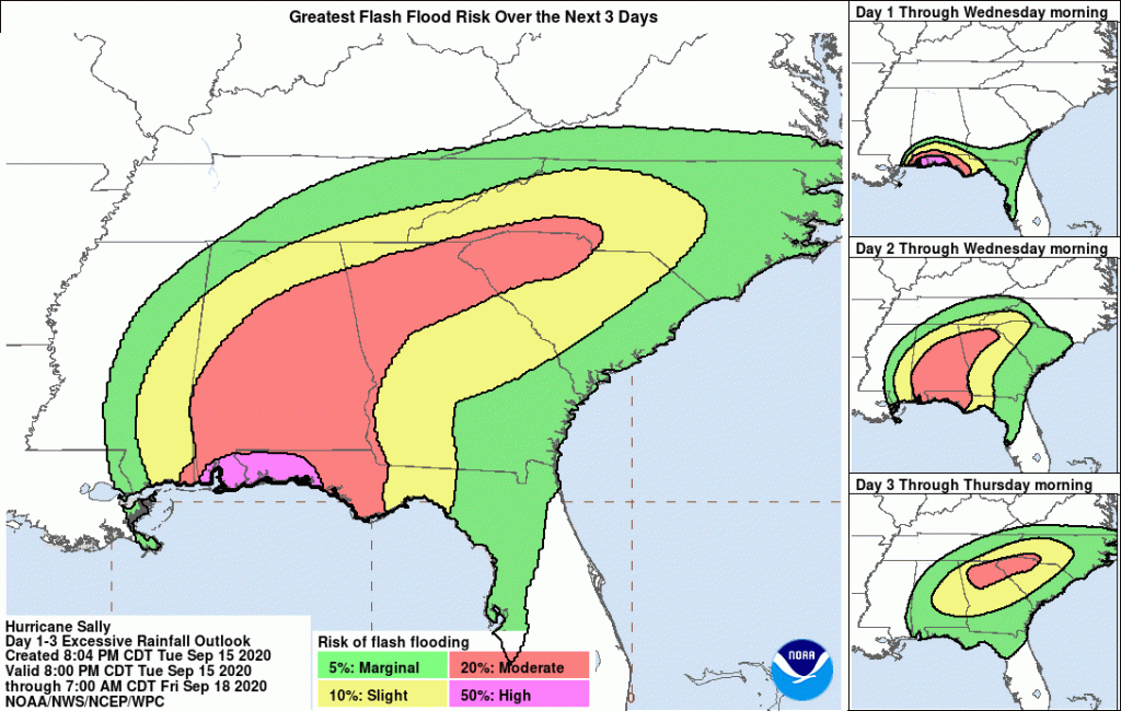
Flash flooding is the biggest concern as isolated spots could ultimately receive 30+ inches of rain. Historic numbers are possible.
WPC Excessive Rainfall Outlook:

Toward the Tallahassee/Albany area, concern is increasing for isolated tornadoes and flash flooding as Sally’s eastern quadrant (most favorable zone for tornadic activity) moves across the area from the south and west. Though rainfall amounts should be considerably less than those in locations in the Western Florida Panhandle, isolated flash flooding could still occur. A Flash Flood Watch is in effect for spots west of Tallahassee and around Albany. Have multiple ways to receive alerts. A lower (non-zero) risk for isolated severe storms exists near Jacksonville and Gainesville.
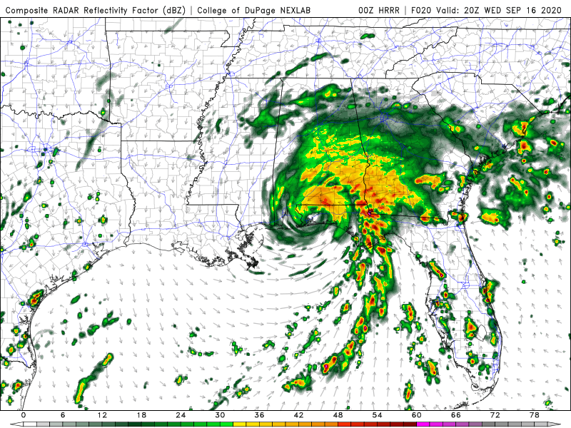
4PM ET Simulated Radar:

When needed, live coverage will be available on Facebook, Twitter, and YouTube. For the latest forecast track, go to cloudsweather.com/tropics. For local radar, head to cloudsweather.com/radars. The latest alerts (for those in the Tallahassee and Jacksonville County Warning Area) can be found @clouds_wx on Twitter.