

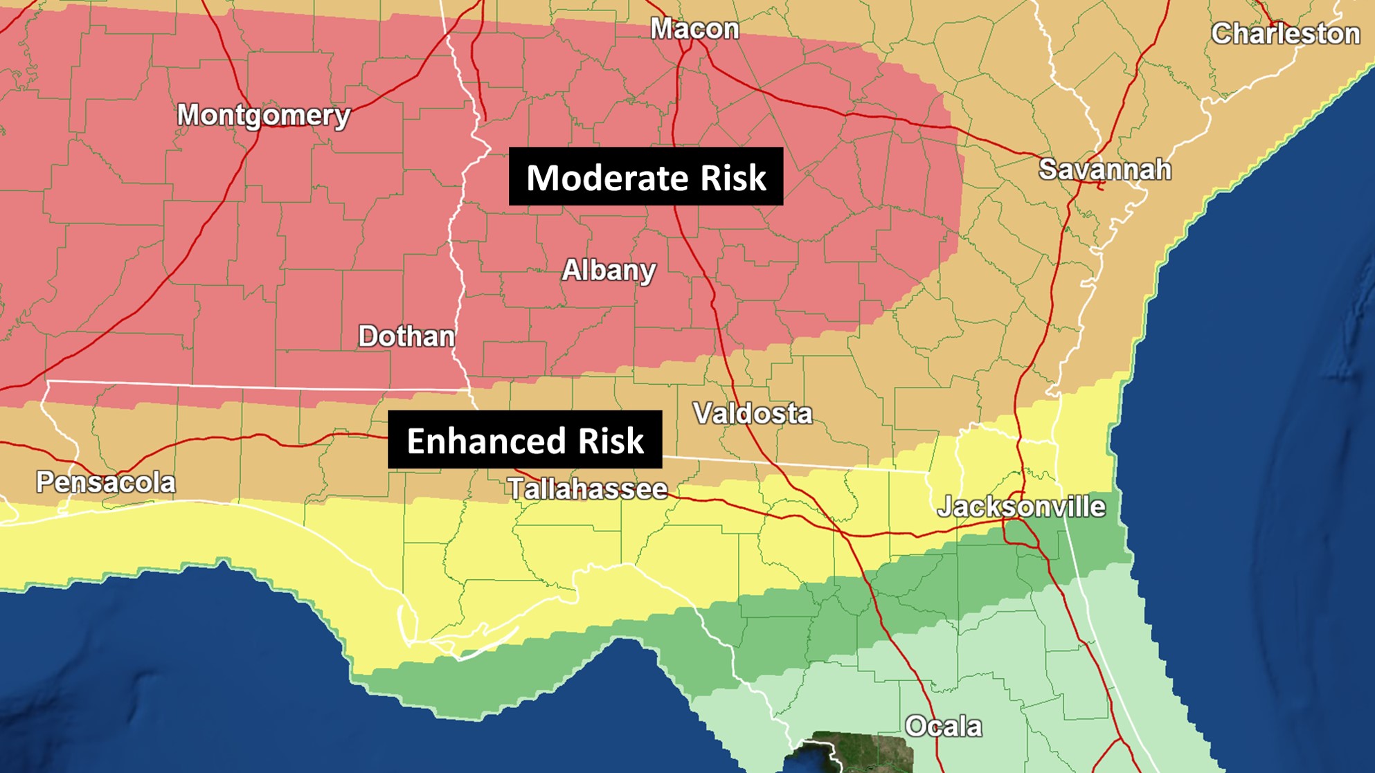
A Moderate Risk for severe storms and tornadoes includes Albany, Columbus, Macon, Montgomery, and Jackson. All modes of severe weather, including some strong tornadoes, could occur. Charge up your devices.
Today’s SPC Tornado Threat Probability (Valid Until 8AM Monday):


While the greatest threat across Southern Georgia still appears to be late tonight into Monday morning, some tornadic activity is possible during the afternoon and evening hours.
4PM Simulated Radar:


Forecast uncertainty is higher than normal. When looking at historical analogs, some high impact events have occurred with similar setups. The location of the warm front is key. As of early afternoon, it was 80 degrees in Valdosta, but only 52 in Macon. The front will be the focal point for severe storms. It will also be where flash flooding concerns are highest.
WPC Flood Potential Map:


A squall line is expected to ultimately move through the Tallahassee/Albany area. Damaging to destructive wind gusts and a few tornadoes will be possible with this. The greatest threat still looks to be in Southern Georgia communities. Make sure to have multiple ways to receive warnings overnight.
6AM Simulated Radar:

Storms should be weakening when they move into Northeast Florida on Monday morning, but, depending on timing, the activity could still have some severe parameters to work with.
Monday’s Severe Weather Outlook:


The active pattern will likely continue as strong to severe storms and heavy rain could move into the region again on Thursday, but specifics are currently unknown.
At times, winds are also becoming strong outside of shower activity. Stay tuned for the latest. As needed, live special reports/updates will be provided on Twitter for significant tornado threats that arise outside of our area and Tallahassee region concerns. Facebook is your source for live Jacksonville area coverage. If a situation develops where severe storms are continuing to move through both areas, coverage will likely stay on Twitter. To receive the latest local NWS alerts and statements, also follow @clouds_wx on Twitter. Recent radar images are available at cloudsweather.com/radars.