Another Severe Weather Outbreak Expected Into Tomorrow
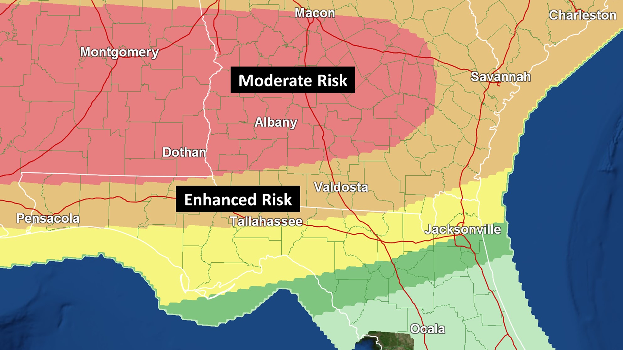
A Moderate Risk for severe storms and tornadoes includes Albany, Columbus, Macon, Montgomery, and Jackson. All modes of severe weather, including some strong tornadoes, could occur. Charge up your devices.

While the greatest threat across Southern Georgia still appears to be late tonight into Monday morning, some tornadic activity is possible during the afternoon and evening hours.

Forecast uncertainty is higher than normal. When looking at historical analogs, some high impact events have occurred with similar setups. The location of the warm front is key.
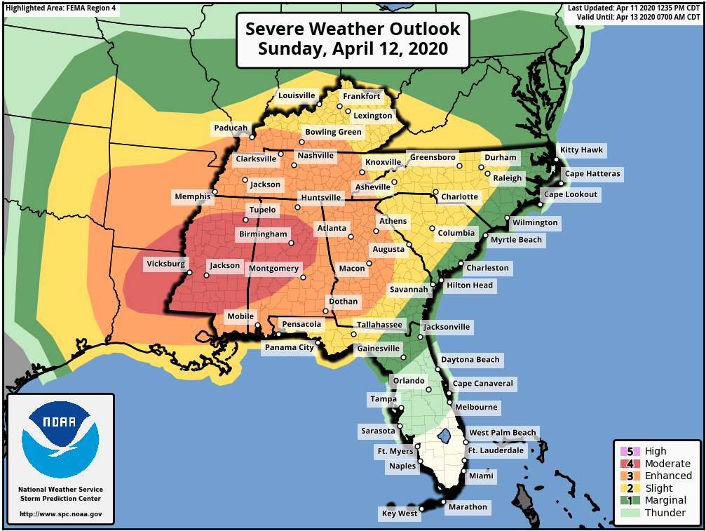
Severe Weather Outbreak Expected Easter Sunday Into Monday Across Parts of Southeast

A Moderate Risk for severe storms on Sunday continues to include Birmingham and Jackson. All threat modes are possible. The Moderate Risk (4/5) area extends westward into parts of Louisiana and Arkansas. Strong tornadoes could occur in this area, but they are also still a possibility in surrounding spots like Atlanta, Memphis, Mobile, and Montgomery.

Locally, Albany and Moultrie are under an Enhanced Risk (3/5) for damaging to destructive wind gusts. These are likely to be associated with a squall line that is expected to track into the Florida Big Bend and Southwestern Georgia very early Monday morning. Tallahassee and Valdosta are currently covered by a Slight Risk. Some tornadic activity will likely be embedded within the line.