
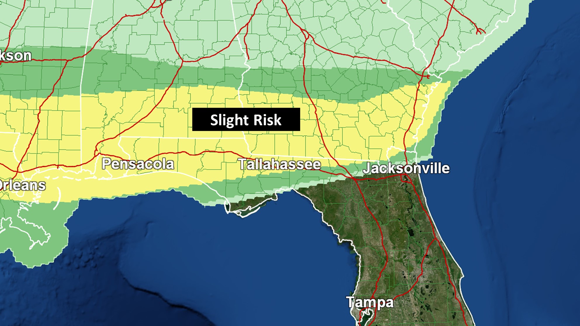
Strong to severe storms could occur today and tomorrow. While computer models are having a tough time handling the situation, isolated tornadoes, damaging wind gusts, and large hail all look like potential threats.
Wednesday’s risk looks greatest across Southern Georgia (Storm Prediction Center Risk Above). A Tornado Watch is in effect until 6PM. Some wind damage has already occurred in Southwestern Georgia. The placement of the warm front is key in determining where today’s storms track. It will also help determine where Wednesday’s highest rainfall amounts should be. Albany, Bainbridge, and Waycross are currently under a Flash Flood Watch. Some of these communities could ultimately receive upwards of five or so inches of rain.
While there should be a lull in the severe potential late tonight, as we head into Thursday, the cold front will approach. It will ultimately spread a higher storm threat into the rest of the area. Tomorrow will likely be the bigger day in terms of aerial coverage of severe storms. Based on my analysis, the threat in the Jacksonville region currently looks highest for those from about Interstate 10 northward. Storms should start weakening around sunset.

Stay tuned for the latest. As warranted, live streaming coverage will be provided on Twitter for Tallahassee region threats. Facebook is your source for Jacksonville area coverage. To receive the latest local NWS alerts and statements, also follow @clouds_wx on Twitter. Recent radar images are available at cloudsweather.com/radars.