
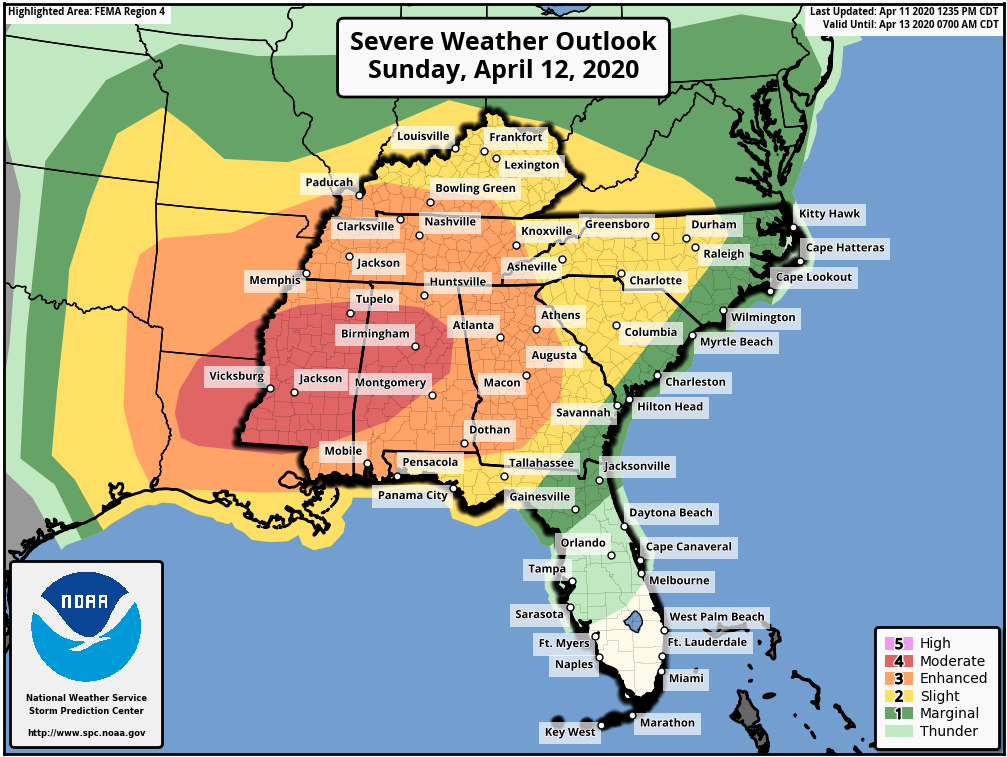
A Moderate Risk for severe storms on Sunday continues to include Birmingham and Jackson. All threat modes are possible. The Moderate Risk (4/5) area extends westward into parts of Louisiana and Arkansas. Strong tornadoes could occur in this area, but they are also still a possibility in surrounding spots like Atlanta, Memphis, Mobile, and Montgomery. Damaging wind gusts and large to destructive hail could occur too. This has the potential to be a historic severe weather outbreak, but some factors (like a lack of destabilization in spots) could preclude this from happening.
Sunday’s Tornado Threat Probability (Valid From 8AM Sunday Until 8AM Monday):
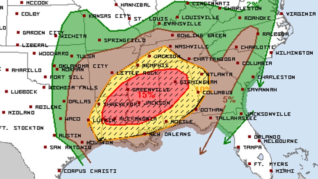
Locally, Albany and Moultrie are under an Enhanced Risk (3/5) for damaging to destructive wind gusts. These are likely to be associated with a squall line that is expected to track into the Florida Big Bend and Southwestern Georgia very early Monday morning. Tallahassee and Valdosta are currently covered by a Slight Risk. Some tornadic activity will likely be embedded within the line. As such, a Tornado Watch will probably be issued late Sunday for much of the Tallahassee area. With this shaping up to be a overnight event for many around Tallahassee and Albany, it will be very important for those in this area to have multiple ways to receive warnings.
6AM Monday Simulated Radar:
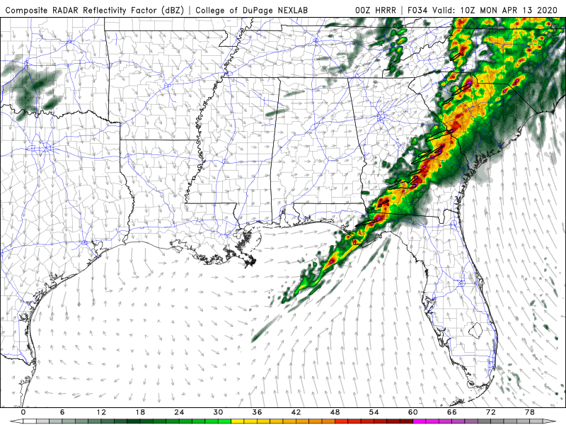
In the Jacksonville area, although a few storms could develop later Sunday afternoon into the evening, severe storms look more likely to occur after sunrise on Monday. Damaging wind gusts and isolated tornadoes will be possible as the squall line moves in, but chances should gradually drop throughout the day as the front stalls over the region. Severe probabilities look greater across the Eastern Carolinas.
Monday’s Severe Threat:

Some strong to severe activity may redevelop across North Florida and South Georgia on Tuesday and Wednesday.
At times, winds will also be strong outside of shower activity. Stay tuned for updates. As warranted, live special reports/updates will be provided on Twitter for significant tornado threats that arise outside of our area and Tallahassee region concerns. Facebook is your source for live Jacksonville area coverage. To receive the latest local NWS alerts and statements, also follow @clouds_wx on Twitter. Recent radar images are available at cloudsweather.com/radars.