
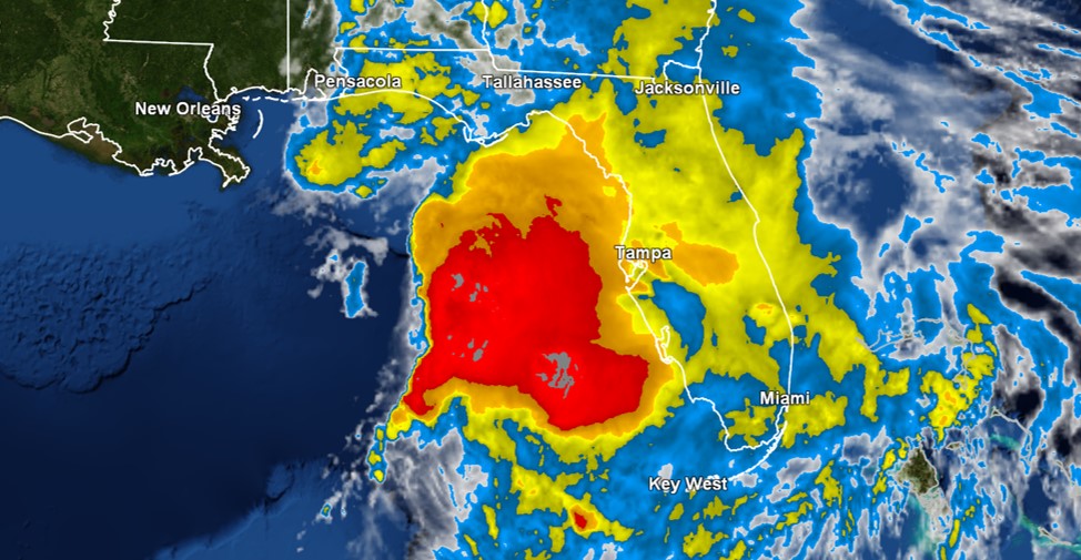
Tropical Storm Nestor officially formed this afternoon in the Gulf of Mexico. As of 8PM, maximum sustained winds remain at 60 mph. The latest official forecast track was nudged a bit east. An early Saturday landfall closer to Apalachicola is now currently anticipated. However, impacts will be felt well east and ahead of the center of this system. Go to cloudsweather.com/tropics/ for the latest advisory and track updates.
A Tropical Storm Warning remains in effect for the entire Florida Big Bend and other nearby communities. Most of the rest of North Florida and South Georgia are under a Wind Advisory for potentially tropical storm-force wind gusts.
A Storm Surge Warning continues for coastal communities from Indian Pass to Clearwater Beach. Spots between Gulf and Citrus counties are at greatest risk. Take a look at this interactive National Hurricane Center map to see which locations could see the worst storm surge flooding.
Isolated tornadoes are another potential Nestor threat. The greatest risk overnight looks to be for areas around Apalachicola and Cedar Key, but also in communities near Tampa and Orlando. The threat will spread across all of North Florida and South Georgia early tomorrow morning. Have ways to receive warnings. This is an unusual tropical tornado setup. In addition to Nestor, two fronts will also move through the region on Saturday. A squall line or two could even develop. Click here for the latest Storm Prediction Center outlooks.
The overall flooding risk is fairly low. This is due in part to Nestor being a quick moving storm and drought conditions across North Florida and South Georgia. Isolated spots could see up to 6 inches of rain though. A look at the latest Weather Prediction Center rainfall forecast is available via this link.
The 0Z HRRR run (loop starts at 3Z; 11PM ET) via COD Weather shows possible timing of Nestor and activity that is associated with it:
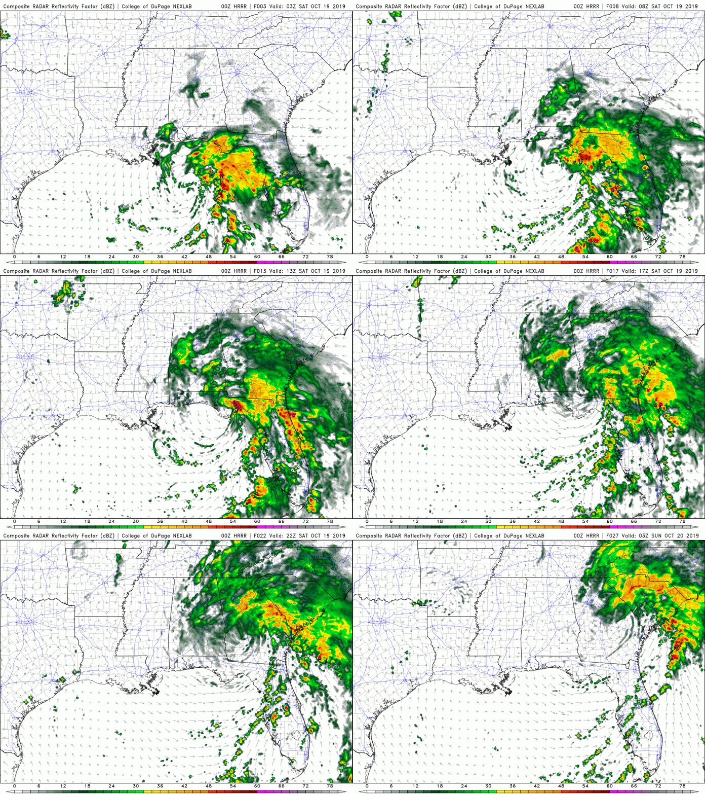
As shower activity moves northeastward, rain chances are high for two college football games of local interest. (9) Florida at South Carolina is scheduled to start at noon. Florida State at Wake Forest should kickoff around 7:30PM. Both look to be wet and breezy.
My plan is to start live streaming coverage on Twitter during the overnight hours. Updates will be provided at the bottom of each hour and as conditions warrant. In the interim, the latest radar imagery will be shown.