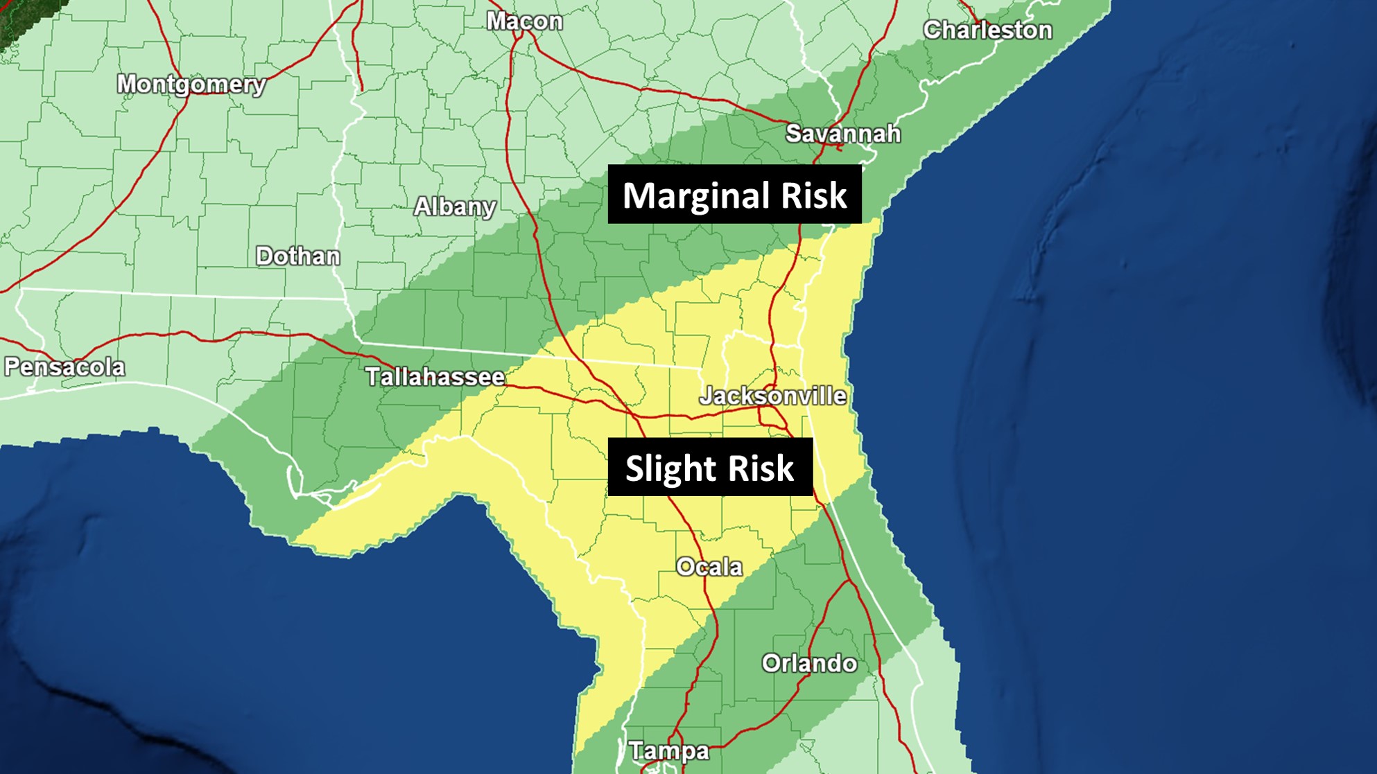
The Storm Prediction Center has placed parts of North Florida and South Georgia under a Slight Risk for severe storms. While damaging wind gusts are the greater threat, an isolated tornado or two cannot be ruled out.
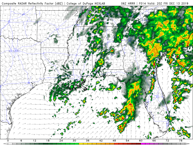
More than one round of showers/thunderstorms will move across most spots. During the afternoon, an isolated strong to severe storm could develop because of an increase in energy around for activity to take advantage of. This threat looks fairly low and would likely be confined to the Jacksonville area. Strong wind gusts are the main concern.
3PM Simulated Radar:
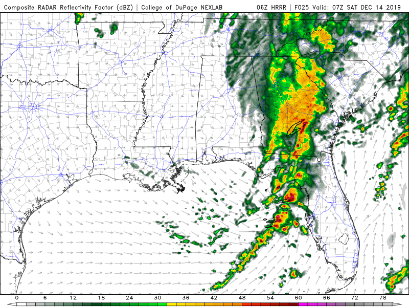
The higher threat appears to be during the evening and into the overnight hours. While there is some uncertainty, atmospheric parameters are looking fairly favorable for a line of storms to develop that will be capable of becoming severe thunderstorm and/or tornado warned. Isolated cells that form ahead of this could also rotate.
2AM Simulated Radar:
Stay tuned for updates. Make sure you have multiple ways to get warnings during the evening and overnight hours. As warranted, live coverage will be provided on Facebook for alerts in the Jacksonville area and Twitter for Tallahassee region concerns.