
An unusual setup is expected to bring more showers and gustier winds to North Florida and South Georgia. The latest forecast model guidance shows that most of the heavier activity should hold off until early tomorrow.
10AM Sunday Simulated Radar:

Sunday looks wet for most spots. Model uncertainty remains, but there are indications that higher rain totals could ultimately be focused over Southern Georgia. A Flood Watch for communities such as Albany and Moultrie will go into effect late tonight. The National Weather Service in Jacksonville has also issued a Flood Watch for those in/near Brunswick and Nahunta. It is looking increasingly likely that moisture will hang around into Monday. Overall, expect many locations to receive between 2 and 4 inches of rain. However, isolated spots could see over 5 inches. This is especially the case for those in the Brunswick area who are now under a Moderate Risk for excessive rainfall Sunday.

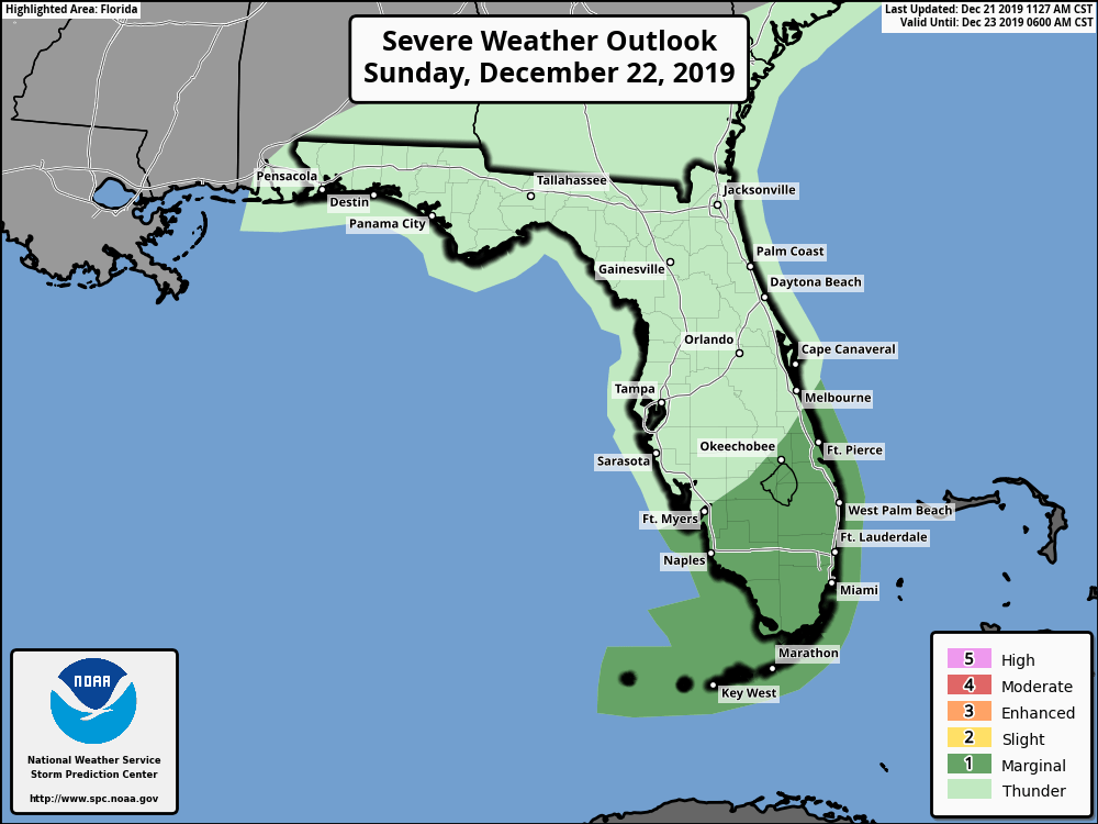
Gusty winds could lead to isolated power outages. In addition, a few strong to severe storms will be possible across the Florida Peninsula Sunday into Monday. As outlined by the Storm Prediction Center, the higher chance for these to occur would be in areas like Miami and Naples.
NWS Jacksonville also notes a few storms could be capable of producing hail across mainly Northeast Florida Monday afternoon. Hazardous weather conditions are expected in coastal spots too.
Stay tuned for the latest. As necessary, the latest radar imagery and/or updates will be streamed live. Go to Facebook for Jacksonville region coverage. Twitter is your Tallahassee area streaming source. If an organized severe threat were to develop over Central/South Florida, live special reports may also be required on Twitter.