

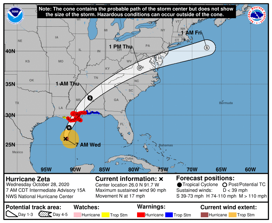
Zeta is quickly strengthening in the Gulf of Mexico. It is now forecast to become a Category 2 hurricane by early this afternoon as it approaches Southeastern Louisiana and Southeastern Mississippi. A Hurricane Warning remains in effect from Morgan City, LA to the Mississippi/Alabama border. It continues to include New Orleans and Gulfport. While five hurricanes have already made landfall in the United States this hurricane season, Zeta is expected to have a bigger impact on New Orleans than any of the others. Depending upon the exact track, it could end up being the most significant tropical event Southeastern Louisiana has experienced in the last decade or so.
As of the 7AM CT/8AM ET advisory, Zeta had maximum sustained winds near 90 mph. It was headed north at 17 mph. Fast storm movement will allow damaging winds to spread well inland into areas of even Central Alabama. Widespread power outages are expected. Those in the direct path of this system need to charge up their devices!
NHC Advisory & Forecast Track:
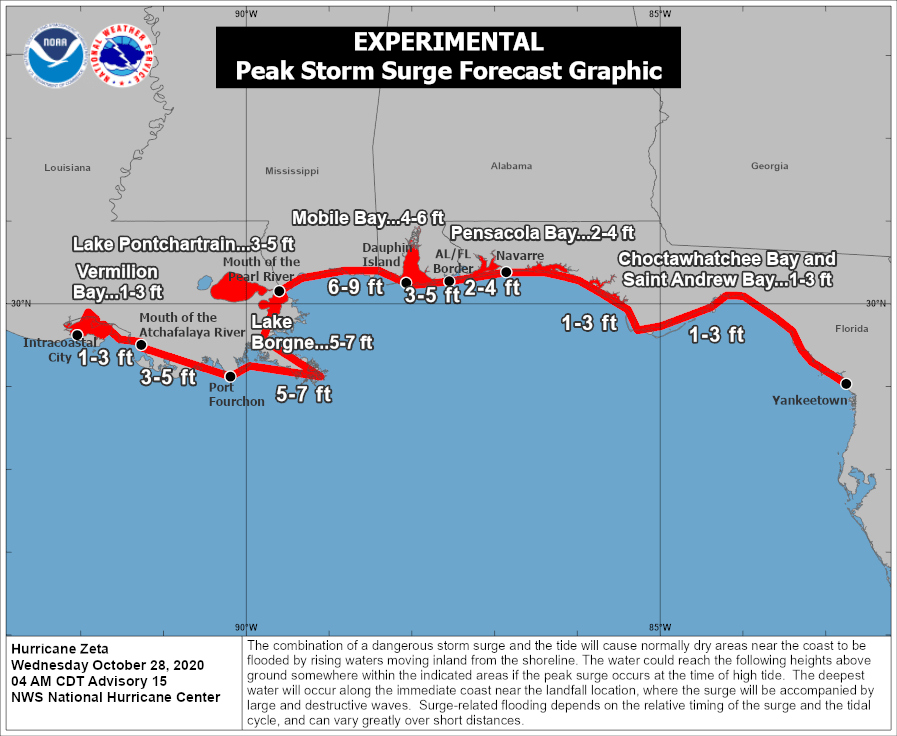
A Storm Surge Warning stretches from the mouth of the Atchafalaya River to Navarre, FL. Those from the mouth of the Pearl River to Dauphin Island, AL look to be at greatest risk.
NHC Storm Surge Expectations:
While the damaging wind potential and storm surge threat should be the biggest dangers from Zeta, isolated tornadoes and flash flooding (lower chance than normal due to the quick movement of the system) could also occur.
6PM CT (7PM ET) Simulated Radar:

Despite a cold front ultimately pushing through and drying things out, conditions could become favorable for isolated tornadic activity out ahead of it across even parts of the Florida Big Bend and Southern Georgia.
Day 1 Zeta Severe Threat (Valid Until 8AM ET Thursday):
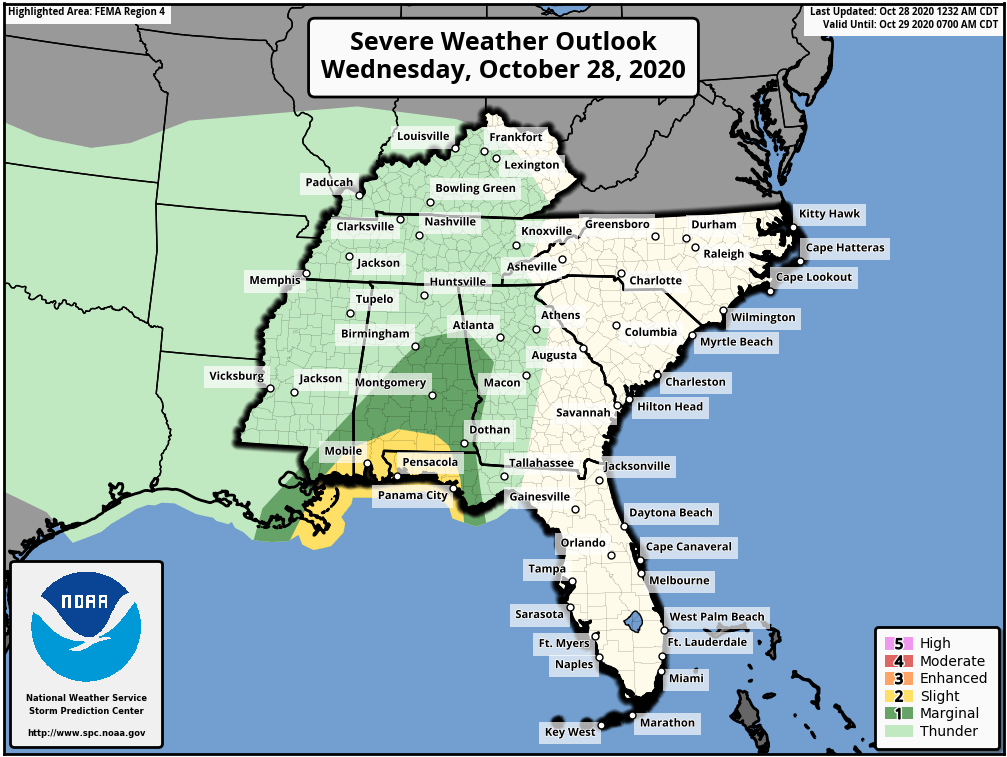
Day 2 Zeta Severe Threat (Valid After 8AM ET Thursday):

When necessary, live coverage will be available on Facebook, Twitter, and YouTube. For the latest forecast track, go to cloudsweather.com/tropics. For local radar, head to cloudsweather.com/radars. The latest Tallahassee and Jacksonville County Warning Area alerts can be found @clouds_wx on Twitter.