Severe Weather Outbreak Expected Easter Sunday Into Monday Across Parts of Southeast
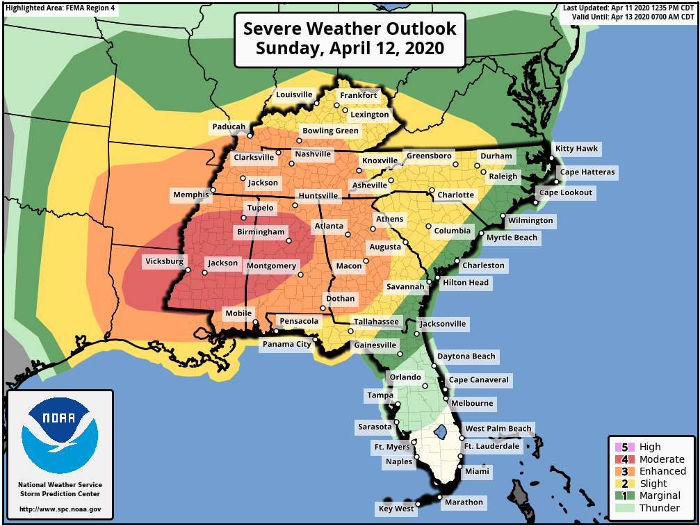
A Moderate Risk for severe storms on Sunday continues to include Birmingham and Jackson. All threat modes are possible. The Moderate Risk (4/5) area extends westward into parts of Louisiana and Arkansas. Strong tornadoes could occur in this area, but they are also still a possibility in surrounding spots like Atlanta, Memphis, Mobile, and Montgomery.

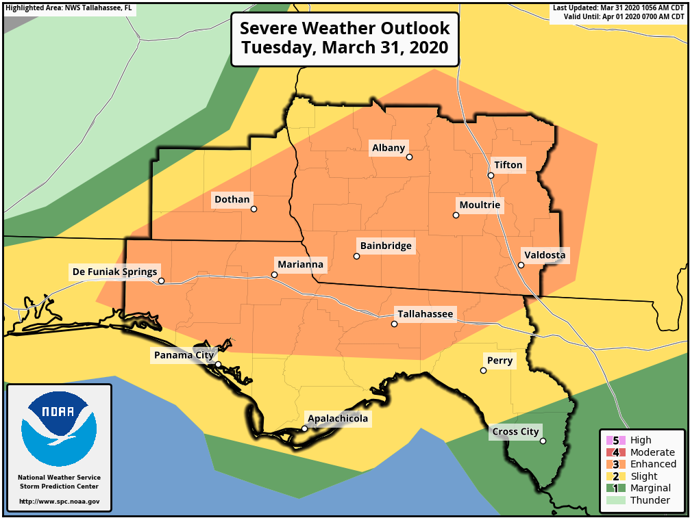
Locally, Albany and Moultrie are under an Enhanced Risk (3/5) for damaging to destructive wind gusts. These are likely to be associated with a squall line that is expected to track into the Florida Big Bend and Southwestern Georgia very early Monday morning. Tallahassee and Valdosta are currently covered by a Slight Risk. Some tornadic activity will likely be embedded within the line.
Severe Storm Threat Today

As of early afternoon, a Tornado Watch was in effect until 4PM for areas around Albany and Bainbridge. A line of severe storms extending from around Pensacola to Eufaula was generally tracking eastward. Damaging wind gusts and tornadoes will remain possible with these storms as they track into Southwestern Georgia, the Florida Big Bend, and across much of the area. Isolated activity out ahead of the main line will also pose a tornado threat. The Storm Prediction Center has upgraded those around Tallahassee and Albany to an Enhanced Risk for tornadoes.

Severe Storms Likely Today

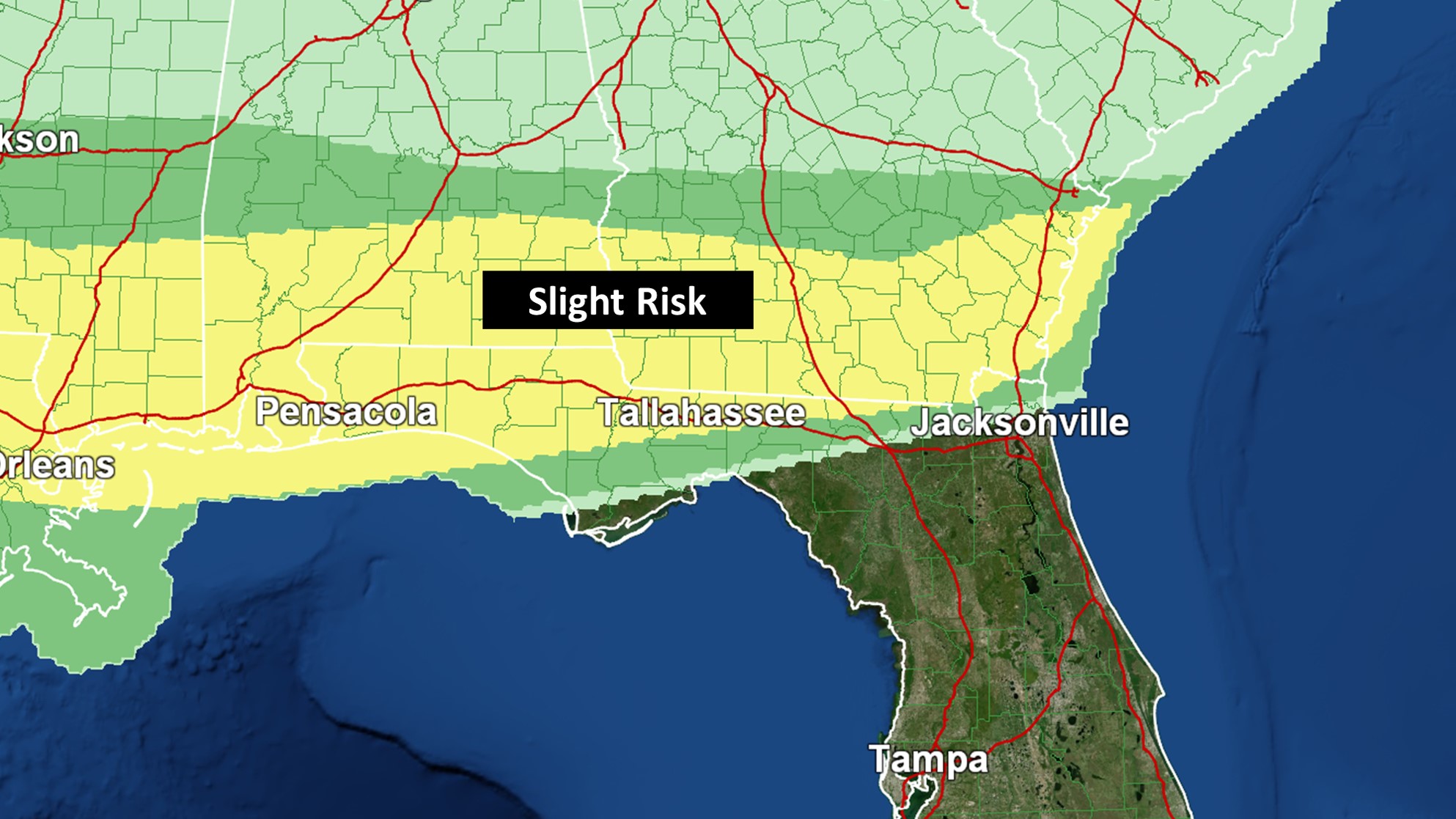
An Enhanced Risk for severe storms covers nearly all of the Tallahassee area and even points east to Lake City. This is where the greatest chance for damaging to destructive wind gusts will be today. Some power outages are likely. Charge up your devices. Isolated tornadoes could also occur. Jacksonville and Gainesville are under a Slight Risk. Some severe weather is still expected there too.