

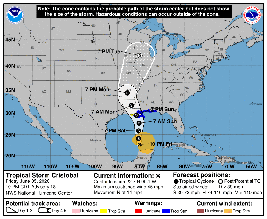
Cristobal is currently expected to make landfall late Sunday in Louisiana as a moderate strength tropical storm. A Tropical Storm Warning remains in effect from east of Morgan City, LA to the Okaloosa/Walton County line in Florida. A Storm Surge Warning covers vulnerable areas from the mouth of the Mississippi River to Ocean Springs, MS. Despite this, indirect/direct impacts will continue to increase across North Florida. This is because the system is an unusually large one and a copious amount of moisture is displaced east of the center. Due to Cristobal’s size, it may also hold together better than some past systems as it tracks into the Midwest and produces nasty weather there too.
11PM Advisory & Official Forecast Track:
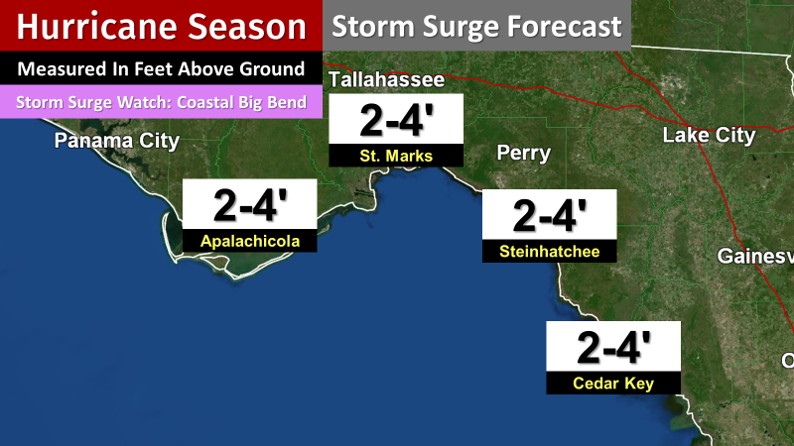
Storm surge will also be a threat for those in coastal communities along the Florida Big Bend. A Storm Surge Watch includes locations from Indian Pass to Aripeka. Storm surge could reach 2 to 4 feet above ground in these spots. In general, this is a more vulnerable region for the hazard.
NHC Big Bend Storm Surge Expectations:
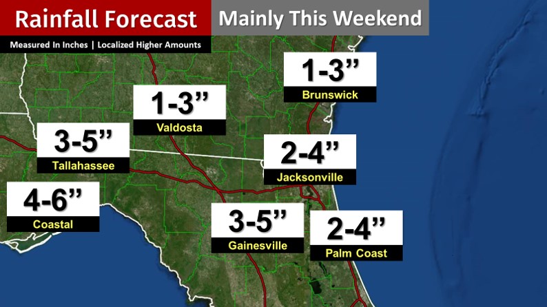
Rain chances are extremely high this weekend for especially North Florida. Rainfall totals of 3 to 5 inches are expected around Gainesville and Tallahassee. Coastal areas could see more. Isolated spots may even receive around 10 inches by the end of the weekend. Locally, as of very early Saturday, Levy County was the only local county under a Flood Watch. However, that could change quickly.
Rainfall Threat:
8AM Sunday Simulated Radar:

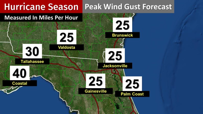
Breezy conditions are expected at times, but winds are generally not expected to gust too high.
Maximum Wind Gust Expectations:
There is a low chance for an isolated severe storm or possibly brief tornado locally. As necessary, special live coverage/updates will be streamed on Twitter (includes Tallahassee area alerts) and Facebook (including for Jacksonville area warnings). Local alerts will also be instantly tweeted at twitter.com/clouds_wx. The latest advisory and track updates are available at cloudsweather.com/tropics. See where shower activity is currently in the local area by going to cloudsweather.com/radars.