
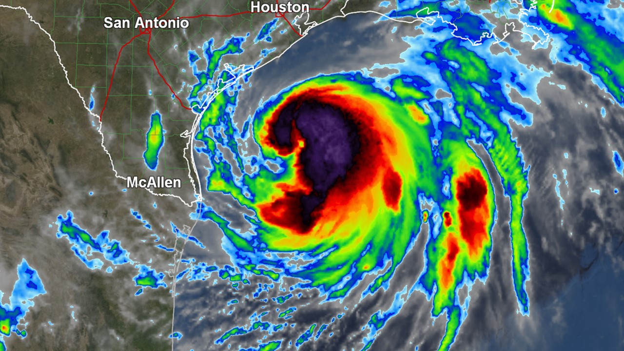
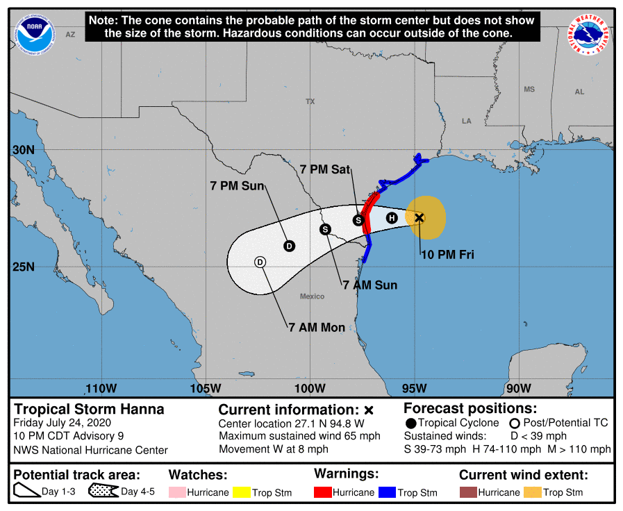
Hanna continues to strengthen as it moves toward the Texas coast. Maximum sustained winds have increased to near 65 mph. A Hurricane Warning is in effect from Port Mansfield to Mesquite Bay. A Saturday PM landfall is expected to occur south of Corpus Christi.
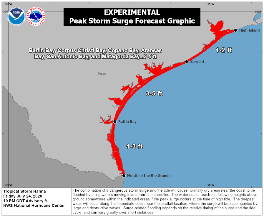
In addition to the threat for winds capable of knocking out electricity in some spots, storm surge is a growing concern. Forecast peak storm surge values have increased to 3 to 5 feet above ground from Baffin Bay to Sargent.
Hanna appears to be an efficient rainfall producer. This also makes the potential for flash flooding an increasing concern in the Corpus Christi and Brownsville area. Some locations could ultimately receive over a foot of rain. Isolated tornadoes may also occur in the region.
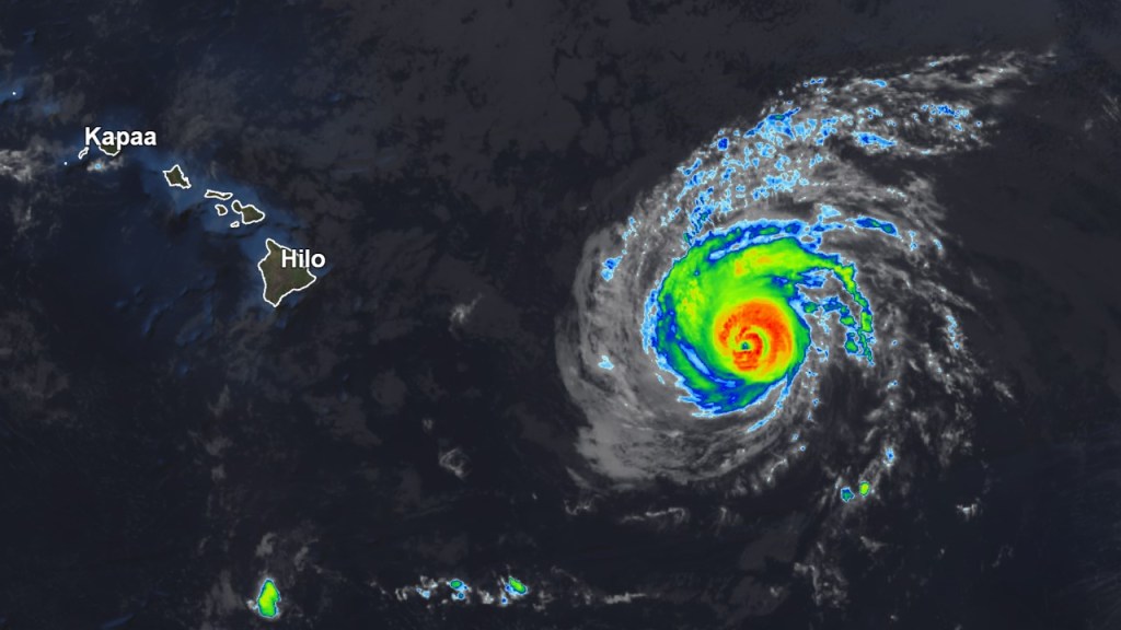
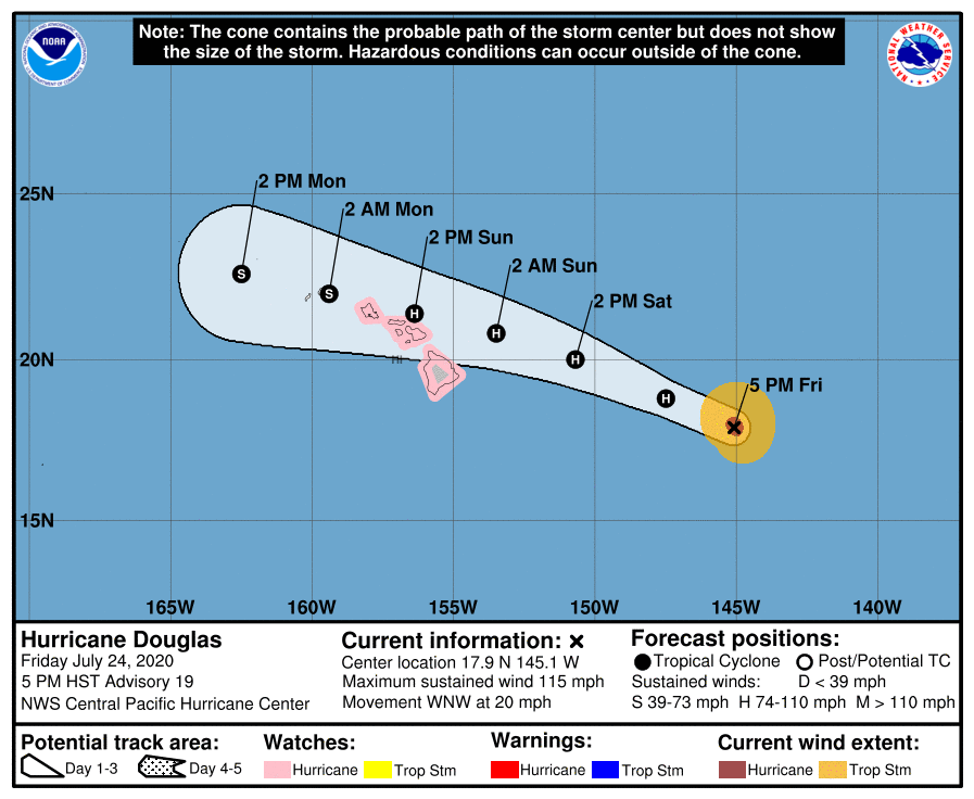
In the Central Pacific, Major Hurricane Douglas is tracking toward Hawaii. A Hurricane Watch includes Honolulu, Maui, and the Big Island. Recent forecasts have trended further north, but it is important not to focus on the exact track as heavy rain and gusty winds are still anticipated. The extent of the impacts should be determined fairly soon.
Tropical Storm Gonzalo continues to barely hang on for now in the Atlantic. It is forecast to dissipate in the next couple of days or so. I will continue to monitor it to make sure it does not redevelop though.

A tropical wave that recently came off the coast of Africa should continue to be followed. It has a medium chance for tropical cyclone genesis within the next five days. Some long-range forecast models hint at this system being one to watch as early August begins.

Stay tuned for the latest. Live coverage/updates will be simulcast on Facebook, Twitter, and YouTube as impacts from Hanna and Douglas increase. For the latest advisory and track updates, go to cloudsweather.com/tropics.