Tracking Hurricane Isaias

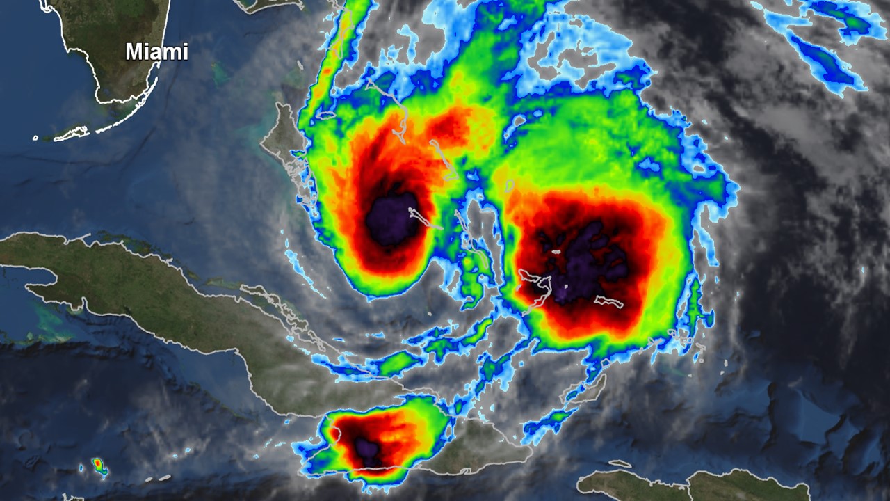
Category 1 Hurricane Isaias is continuing to impact parts of the Bahamas. As it gets closer to Florida, the hurricane is expected to turn to the north. Isaias’s exact track will determine what type of impacts the Florida Peninsula and Southeast Georgia receive. A Hurricane Warning is in effect from Boca Raton to the Flagler-Volusia County line. In our coverage area, Coastal St. Johns and Flagler counties are under a Tropical Storm Watch and Storm Surge Watch.
Tropics Become Very Active as Two Systems Threaten United States

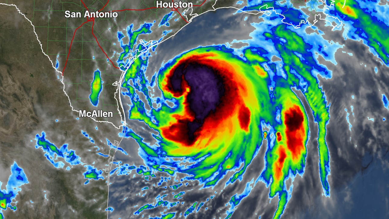
Hanna continues to strengthen as it moves toward the Texas coast. Maximum sustained winds have increased to near 65 mph. A Hurricane Warning is in effect from Port Mansfield to Mesquite Bay. A Saturday PM landfall is expected to occur south of Corpus Christi.

In the Central Pacific, Major Hurricane Douglas is tracking toward Hawaii. A Hurricane Watch includes Honolulu, Maui, and the Big Island.

Tracking Tropical Storm Cristobal

Cristobal is currently expected to make landfall late Sunday in Louisiana as a moderate strength tropical storm. Despite this, indirect/direct impacts will continue to increase across North Florida. This is because the system is an unusually large one and a copious amount of moisture is displaced east of the center.

Storm surge will also be a threat for those in coastal communities along the Florida Big Bend. A Storm Surge Watch includes locations from Indian Pass to Aripeka. Storm surge could reach 2 to 4 feet above ground in these spots.

Enhanced Severe Risk For Most of North Florida & South Georgia

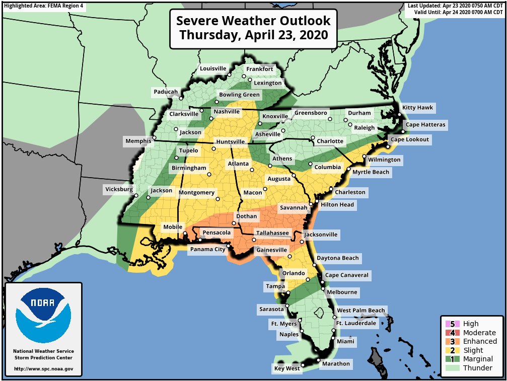
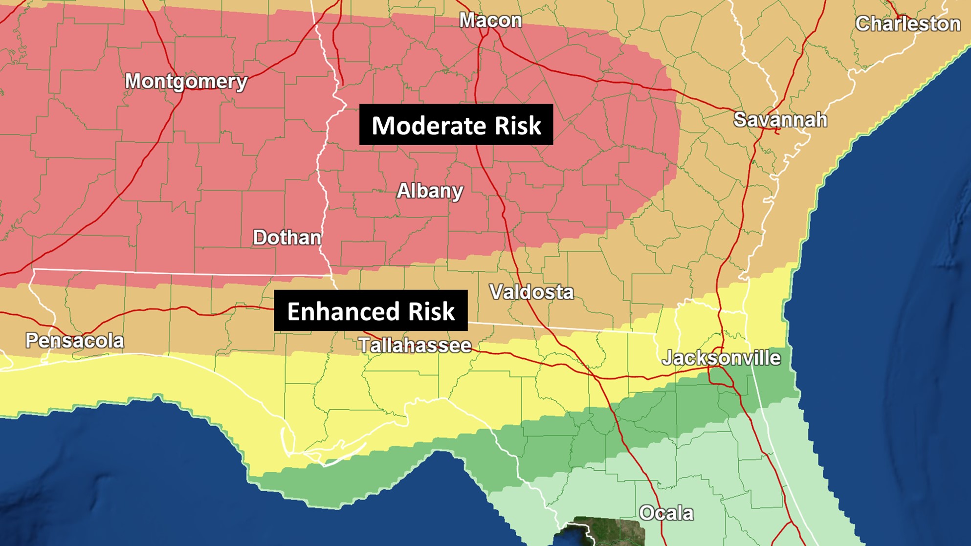
Albany, Tallahassee, Valdosta, and Waycross are all under an Enhanced Risk (3/5) for tornadoes and damaging wind gusts today. A Tornado Watch was recently issued for much of Southern Georgia and the Florida Big Bend. Isolated strong tornadoes will be possible.

The Enhanced Risk extends into Jacksonville, Lake City, and Starke for the damaging wind threat, but isolated tornadoes still cannot be ruled out.

Like the most recent severe threat, forecast uncertainty is a big issue. However, there are indications that there will be multiple rounds of strong to severe storms.

Another Severe Weather Outbreak Expected Into Tomorrow

A Moderate Risk for severe storms and tornadoes includes Albany, Columbus, Macon, Montgomery, and Jackson. All modes of severe weather, including some strong tornadoes, could occur. Charge up your devices.

While the greatest threat across Southern Georgia still appears to be late tonight into Monday morning, some tornadic activity is possible during the afternoon and evening hours.

Forecast uncertainty is higher than normal. When looking at historical analogs, some high impact events have occurred with similar setups. The location of the warm front is key.