There are two areas of interest that the National Hurricane Center is watching in the Atlantic for potential development. In the Pacific, Hawaiians are monitoring the progress of two hurricanes that will weaken as each one moves closer to their state.
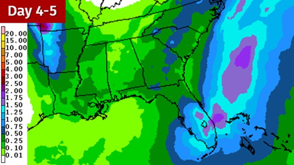
Area #1 is located around Puerto Rico and Hispaniola. It only has a 10 percent chance of formation in the next five days. However, it should be one of the factors that helps to increase shower and storm chances (especially for the Florida Peninsula) as the weekend approaches. The image below is a rainfall forecast from the Weather Prediction Center that is valid from Friday night to Sunday night.
Area #2 is currently SSW of the Cabo Verde Islands. It has the greater chance to develop. During the next five days, the National Hurricane Center says this system has a 40 percent chance to do so. In the long-term, it seems more likely than not that this system will ultimately become a tropical cyclone. The big question is where will it go. Very early indications suggest it might recurve east of the United States. However, the system needs to develop further before forecast models will be able to get a better handle on where it could track. Any potential impacts from this system would be more than a week away. There is plenty of time to watch it.
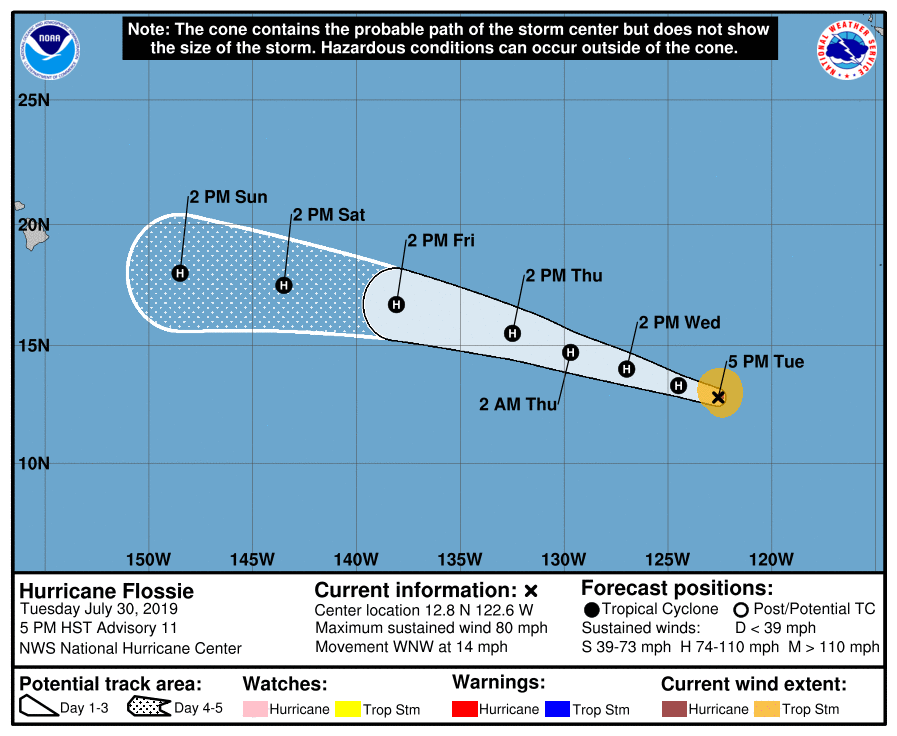
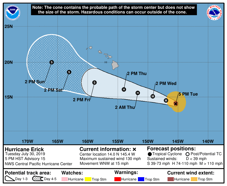
Two hurricanes, Erick and Flossie are tracking across the Pacific.
Major Hurricane Erick rapidly intensified into a Category 4 storm. It is expected to pass south of Hawaii Friday into the weekend as it significantly weakens. There could be some fringe effects felt from this system there as rain chances and wind speeds increase.
Flossie is further east, but seems to pose a more direct threat to Hawaii. It could track closer to or over parts of the state. It will also weaken as it moves into cooler waters. However, specific impacts to the Hawaiian Islands from this system cannot be nailed down at the present time.