Hurricane Dorian continues to be monitored very closely. It devastated parts of the Bahamas. When it made landfall on Great Abaco Island (near Marsh Harbour) with 185 mph maximum sustained winds, it tied the 1935 Labor Day Hurricane for the strongest Atlantic hurricane landfall on record. Catastrophic storm surge also occurred. For the first time in recorded history, at least one Category 5 hurricane has now occurred in the Atlantic Basin for four consecutive years.
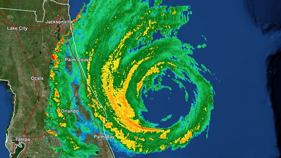
This storm is expected to track off to the east of North Florida and South Georgia. A Hurricane Warning remains in effect from Sebastian Inlet to Ponte Vedra Beach. A Hurricane Watch and Tropical Storm Warning covers our coastal communities to the north. The greatest impacts will be in coastal areas. Storm surge looks to be the biggest threat with heights 3 to 5 feet above ground forecast in some spots. Hurricane-force wind gusts, flash flooding, and isolated tornadoes are the other noteworthy hazards. Models have recently trended toward a track closer to the coast, but a Florida or Georgia landfall is not expected. A landfall in the Carolinas could occur though. Impacts look to be greater there.
I am providing numerous updates on social media. They will continue through the duration of the storm. Watch live streaming radar and satellite on facebook.com/CaseyCloudWX and facebook.com/cloudsweather. Starting at 8:30AM, updates will be provided at the bottom of each hour. Additional updates will be provided as conditions warrant. Up to the minute information is also available on twitter.com/CloudCasey and twitter.com/clouds_wx. For each track and advisory update go to cloudsweather.com/tropics/.